
A Realistic Benchmark for Domain Generalisation across Geographic Regions for Land-Use Classification
Why Spatial Domain Shift Matters?
Deep learning models often assume that training and deployment data come from the same distribution. In real-world applications, this assumption breaks dramatically when models trained in one geographic region are deployed in another. Differences in architecture, land cover, culture, and development introduce spatial domain shift a major obstacle to having a robust AI system at global-scale for earth observation.
Spatial Domain Shift in Earth Observation: An Example
Imagine this scenario unfolding in practice.
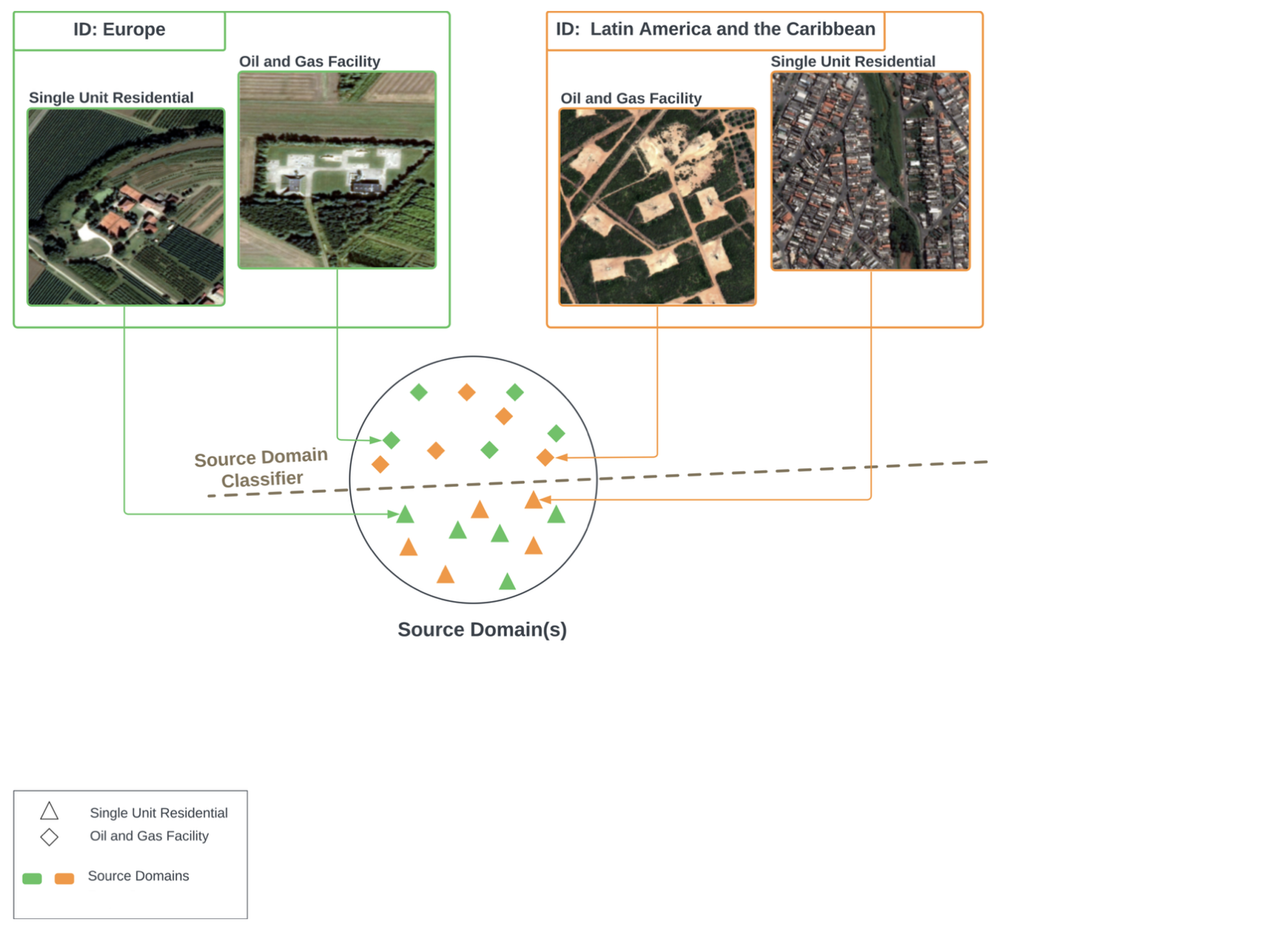
You train a deep learning model on satellite imagery from Europe and Latin America and the Caribbean, teaching it to recognise just two classes: single-unit residential buildings and oil and gas facilities. With sufficient training, and a touch of fine-tuning, the model appears to excel. It confidently separates rooftops from refineries, delivering strong performance metrics and giving every impression that it has mastered the task.
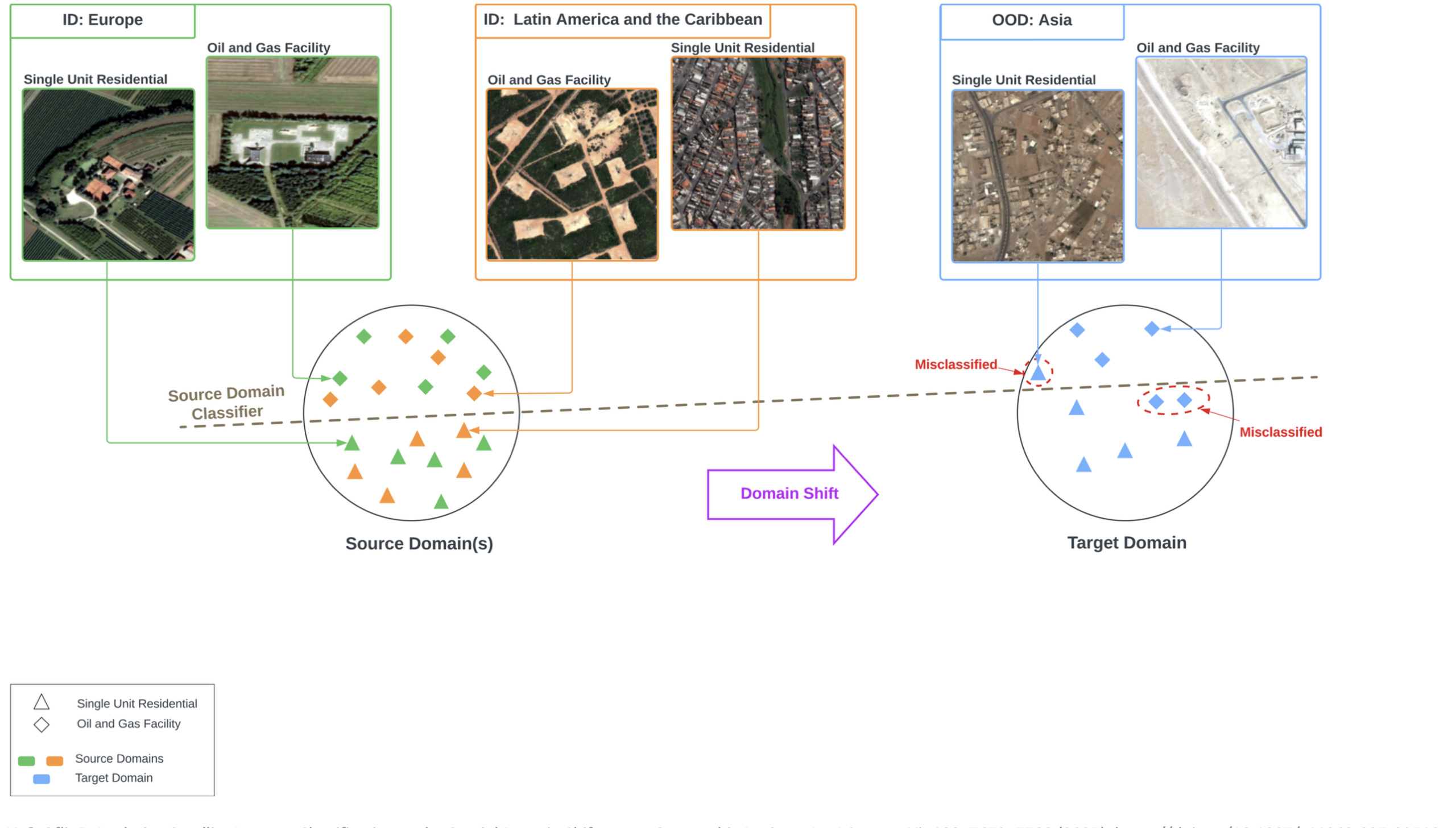
Then comes deployment, also know as test time, when the model is exposed to the real world.
This time, however, the incoming satellite data comes from Asia. Almost immediately, the model begins to struggle. Structures it once identified with ease now confuse it. Residential homes are misclassified as oil and gas sites. Although the classes themselves have not changed, the model struggles badly, exposing a crucial weakness in its understanding.
The DSGR Dataset
Domain Shift across Geographic Regions (DSGR) is a new domain generalisation benchmark dataset designed to capture spatial domain shift in satellite imagery classification. In DSGR, the domains are defined according to six globally defined geographic regions following the United Nations classification.
Asia, Africa, Oceania, Europe, Latin America & Caribbean, Northern America
Land-use categories such as airports, residential areas, oil facilities, parks
High-resolution satellite imagery with global coverage
Including underrepresented regions often missing from benchmarks
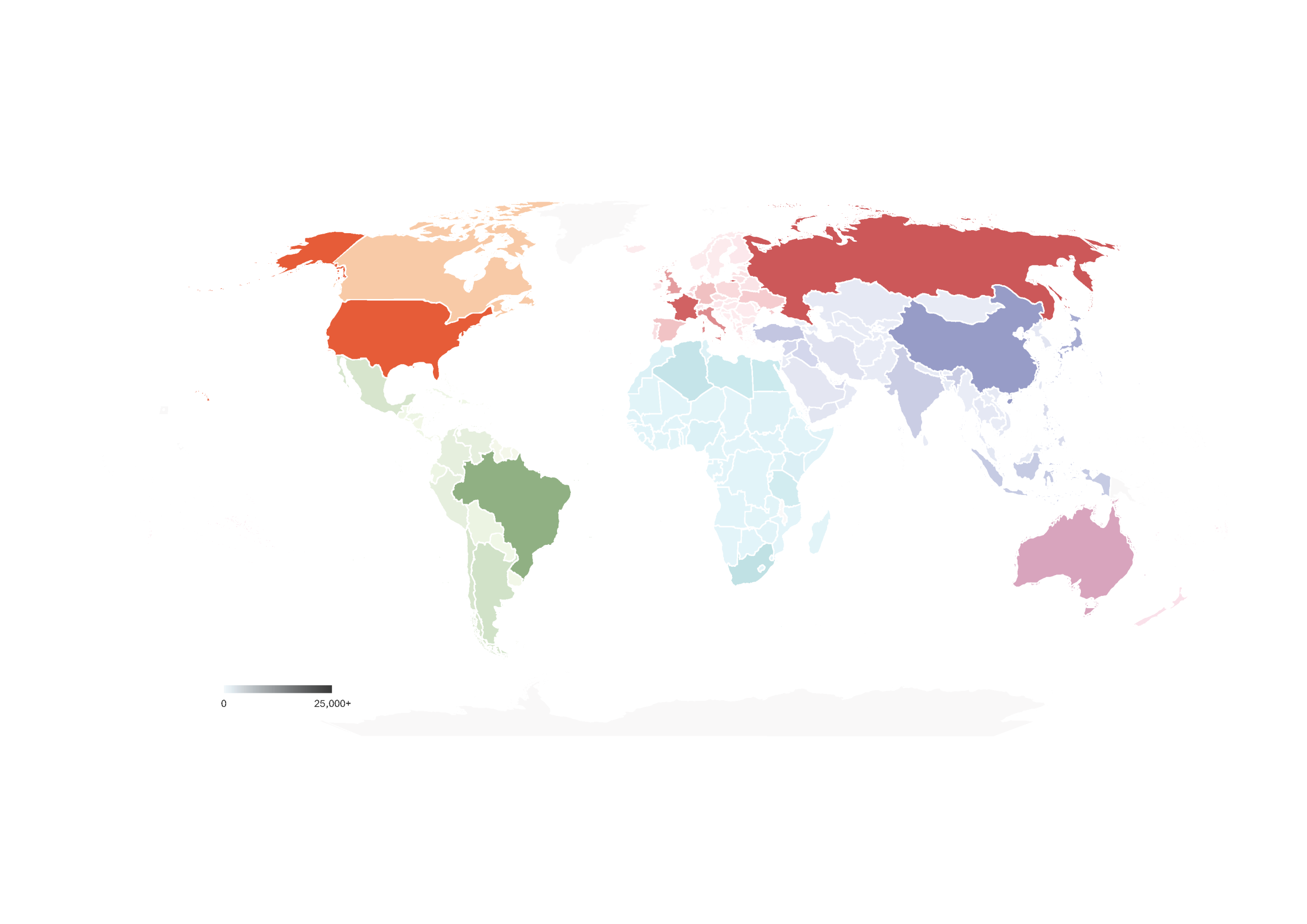
The geographical distribution of DSGR which indicates a global representation is shown below. The different colours represent the six different geographic regions in DSGR individually. Whereas, the shades represent the number of samples per country within each region
Key Contributions
🌍 Novel Dataset
Introduced DSGR, a realistic and challenging DG dataset covering six geographic regions globally.
🔬 Comprehensive Analysis
In-depth investigation of different training schemes, including single-source vs. multi-source training, revealing that multi-source training significantly improves model generalisability across spatial domains.
🤖 Foundation Model Insights
Demonstrated that classical ERM with CLIP as backbone outperforms recent state-of-the-art domain generalisation methods.
📊 Benchmark Results
Extensive benchmarking of SOTA domain generalisation algorithms (ERM, IRM, Deep CORAL, group DRO and CLIPood) revealing their performance variations under spatial domain shift.
📋 And much more
Find out more about our work here .
Access the Resources
Citation
If you use DSGR in your research, please cite our paper:
@article{dsgr_2025,
  title={Analysing satellite imagery classification under spatial domain shift across geographic regions},
  author={Al-Emadi, Sara A and Yang, Yin and Ofli, Ferda},
  journal={International Journal of Computer Vision},
  volume={133},
  number={11},
  pages={7672--7709},
  year={2025},
  publisher={Springer}
}
Contact
For questions or collaboration opportunities, please contact: salemadi@hbku.edu.qa.